THE BLEICHERT ROPEWAY


The Bleichert Ropeway: Industrial Heritage.
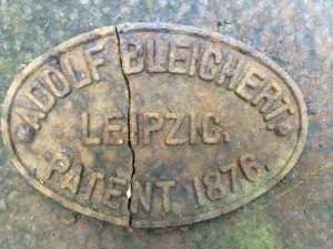
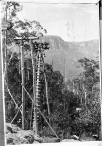
Built by German engineers Adolf Bleichert & Company in the 1880s, the Bleichert Ropeway carried coal and oil shale across the Jamison Valley. It was one of the first examples of industrial-scale coal and shale oil mining infrastructure in Australia and it played a key role in the history of the Katoomba community and the development of the Blue Mountains. Yet it is unknown to many in the community.
PROJECT OBJECTIVE
To raise community awareness of the region’s mining heritage and the fascinating story of the Bleichert Ropeway in the Jamison Valley in the Blue Mountains World Heritage site. Conducting a field survey of remaining heritage items and computer simulation to illustrate its operation.
About the Ropeway
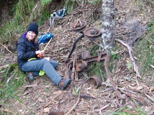
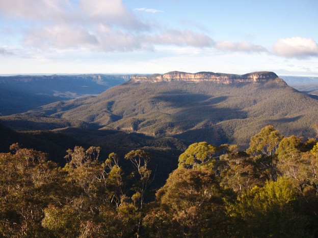
Built by German engineers Adolf Bleichert & Company in the 1880s, the Bleichert Ropeway carried valued coal and oil shale across the Jamison Valley in the Blue Mountains. It was one of the first examples of industrial scale coal and shale oil mining infrastructure in Australia. The Ropeways’ remains now lie in the Blue Mountains National Park and on private land owned by Scenic World.
This heritage played a key role in shaping the history of the Katoomba community, and the development of the Blue Mountains. Yet it is unknown to many parts of the community, particularly the younger generation.
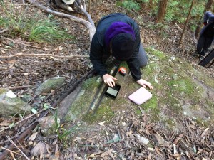
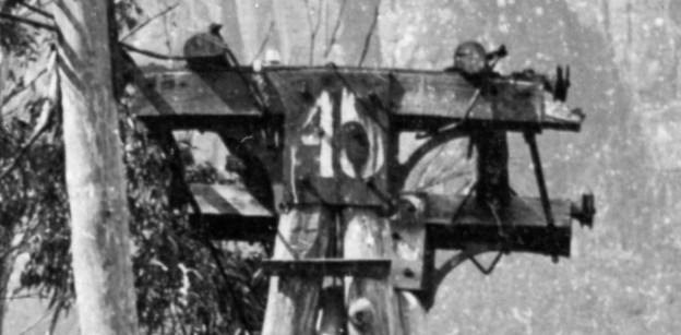
This project raised awareness within the local community, and undertook a comprehensive field survey documenting over 300 artefacts to better understand, conserve and celebrate this heritage. A customised smartphone and tablet-based app was developed through the Federated Archaeological Information Management Systems (FAIMS) project. See www.fedarch.org
This work consolidated past voluntary research and recording of artefacts, and has significantly advanced our knowledge of the Ropeway. It has advanced our understanding of the conservation and interpretation requirements of the remains of the Ropeway, and will assist responsible agencies to implement appropriate conservation policies and management.
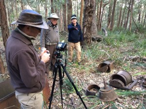
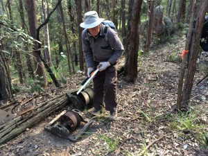
Over seven days in June-July 2014, the survey team including UNSW FAIMS researchers, BMWHI staff, NSW OEH, Scenic World and community bushwalking volunteers undertook a full survey of the Bleichert Ropeway route.
In February 2015, approximately 100 participants attended a community celebration at Scenic World.
Presentations included a history of the Bleichert Ropeway by Phillip Hammon; a report of the Archeological study by Dr Penny Cook; and a explanation of the digital gaming simulation, and virtual museum of the Bleichert Ropeway and its relics by Dr Russell Lowe and Masters students.
The Institute and its partners are pursuing additional grant funding to undertake further work on the Bleichert Ropeway. This will include further archaeological investigation of the Ropeway; the development of a citizen science version of the smartphone/tablet app to allow ongoing recording of artefacts thereby augmenting the existing FAIMS database; and submission of an application to add the Ropeway to the NSW State Heritage List.
REPORTS AND PUBLICATIONS
Final Report – Bleichert Ropeway Survey 2015 (pdf)
For more about Katoomba’s mining history see Philip Hammon and Philip Pells, The Burning Mists of Time (2011).
The following site maps are courtesy of Philip Hammon and Philip Pells: Bleichert Ruined Castle & Gladstone Colliery.
'Old ropeway dug up on daring adventure', Blue Mountains Gazette, 18 March 2015
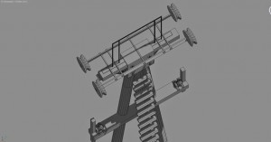
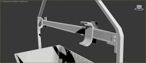
Bleichert Simulation: developed by Russell Lowe and Masters students, UNSW. See below.
For information on the database assembled by the FAIMS project team please contact Shawn Ross (shawn@fedarch.org or shawn.ross@mq.edu.au).
